Tibetan Plateau: Definition, Location, Formation and Interesting facts
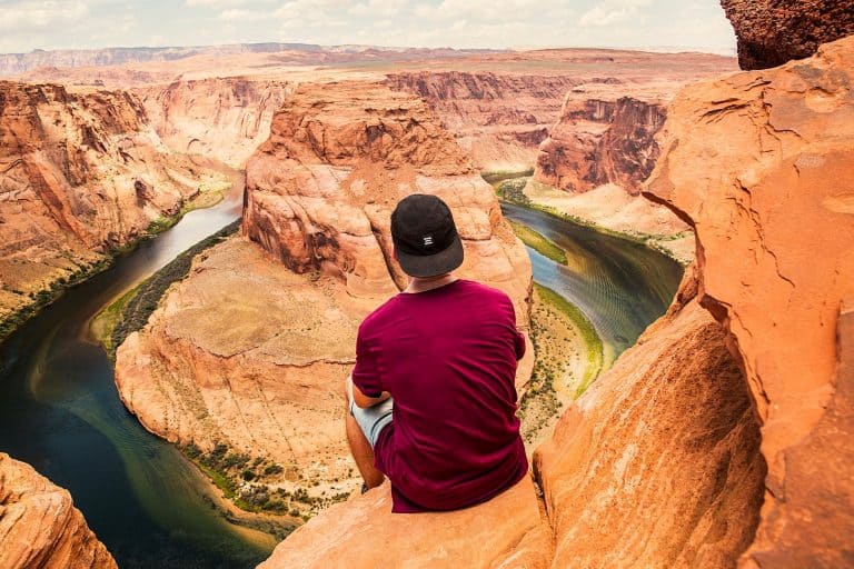
On a general note, plateaus are interesting landforms that are spotted all over the world. Plateaus are extensive landforms that usually have a flat or sloping top and the elevation of most plateaus usually ranges from a few hundred to several thousand meters.
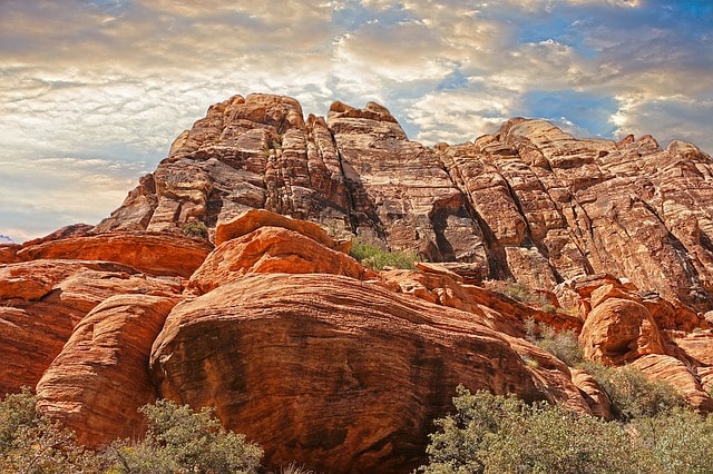
Usually, plateaus are larger than mesas (a flat elevated area which is relatively flat and elevated with steep sides that is less extensive than a plateau) or buttes (a flat-topped hill which rises abruptly from a flat area of land with steep sides and a flat top). Most plateaus are riven by erosion into deep canyons. A peculiar and notable example of a plateau is the one found in North America, popularly known as ‘Columbia plateau.’
The name of the Tibetan Plateau really inspires a lot of awe in our minds. The mighty plateau is not just a great sight to behold, but also, it is a feat of Nature. Its formation, its stature is nothing short of a magnificent affair. However, the spectacular Tibetan Plateau has more to it than meets the eye. In this article, you will get to know exactly when and how was Tibetan Plateau formed? Where is it located, and what are its surroundings? How huge is this majestic plateau? So read on to find out more about it and get ready to be amazed!
Definition of the Tibetan Plateau
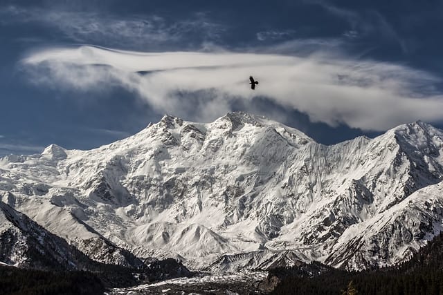
The “Roof of the World”, the Tibetan or the Himalayan Plateau is the highest and the largest plateau in the world. The Tibetan plateau is surrounded by super tall mountains which includes two tallest mountains in the world (Mount Everest and K2). Like a typical plateau, it is the “table land” on the top of some extremely steep slopes. Worth mentioning is that this rugged terrain holds an enormous amount of glaciers that quenches the thirst of almost the whole of Asia. It is in fact, the largest reserve of freshwater outside the Poles.
For this reason, sometimes, this magnificent plateau is also called the Third Pole. Encompassing an area that is larger than Western Europe, the Tibetan Plateau is of great cultural as well as geological importance. The plateau, which covers the “largest tropical glaciological area in the world,” feeds the three largest rivers namely – the Mekong, the Ganges, and the Yangtze.
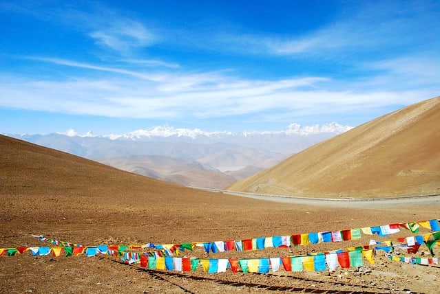
The plateau is actually an arid, high altitude steppe that is interspersed with brackish lakes and with some mountain ranges. With annual precipitation of about 100 to 300 milliliters, the most significant form of precipitation in the region is rain. As one proceeds north and northwest, the plateau gets higher, drier and colder.
It has been observed that the surface of the Tibetan Plateau is dotted with salt lakes and marshes. The plateau crossed by several mountain ranges, it contains the headwaters of many major southern and eastern Asian rivers, including those of the Indus, Ganges, Brahmaputra, Mekong, Yangtze (Chang Jiang), and Huang He (Yellow River).
At Changtang, the average altitude of the plateau is more than 16,000 feet, and the winter temperatures here drop down to about -40 degrees Celsius. Owing to such extremities of climate, the Changtang region is one of the most sparsely populated regions of Asia. Frost here lasts for almost 6 long months of the year. The vegetation and the conditions here are suitable for sustaining nothing other than the nomadic population.
Its landscape is bleak, barren, and rock is strewn. By the northern margins of the Tibetan Plateau where it merges into the northwestern steppe and desert is the Qaidam Pendi, a large depression that extends from east to west. Interestingly, Qaidam Pendi consists of mountains, hills, stony and sandy deserts, playas (desert basins that periodically fill with water), and salt marshes.
Formation of the Tibetan Plateau
The formation of the Tibetan Plateau is really, a tale in itself. The formation of the Tibetan Plateau and its craggy peaks has always beguiled scientists. According to a geologic tale, it is believed that about 150 million years ago when India got separated from Africa, breaking up of the supercontinent called Gondwanaland, the northward movement of the Indian plate at the rate of approximately 150 millimeters per year was extremely fast. Next what happened is that, about 55 million years ago, the Indian slab hit the Asian plate at full speed.
As it slammed into the bigger landmass, the plateau; the Karakoram and Himalaya ranges were formed. Shedding more light to this story was the review of research on the evolution of the Tibetan Plateau which was published in the 22nd August 2008 issue of the Journal of Science. In the review, a group of researchers puts together in a more logical manner the various processes that led to the formation of the Tibetan Plateau.
It is explained that before India actually rammed into Eurasia, the Tethys Ocean (which separated the landmasses) was subducted beneath Eurasia. Thus, in the late cretaceous (approximately 100 to 65 million years ago) a volcanic mountain range similar to the modern Andes developed along the southern edge of the Eurasian plate. The earlier tectonics would have begun to raise some portions of the Tibetan plateau above sea level and thickened the continental crust there, the researchers reported, thereby setting the stage for what is to come up later in the formation process.
Following the collision, more of the area now included in the plateau was involved in the tectonic changes with the southern and central portions of Tibet reaching very elevations (however, the Northern portions remained low) as the crust shortened or compressed. Therefore, as the crust was compressed, the towering peaks that make up the Himalayas and the Karakoram were gradually pushed up to the amazing height at which they stand today.
Furthermore, as the collision continued, material from the lithosphere (i.e the solid outer shell of the planet) below the surface crust was shifted toward the east. The portions of the lithosphere were aided by the eastward movement of subduction trenches in the Pacific Ocean to the East of what is now known as China.
Therefore, about 20 million years ago, the trenches’ eastward movement stopped. This hindered the movement of materials generated when the Indian and Eurasian plates continued to collide. Some geologists are of the belief that crustal shortening continued to build up the Eastern plateau (although there is little evidence for this). Thus, it is believed that the pile-up of Lithospheric material beneath the plateau continued to thicken the crust and raise the eastern portion of the plateau which resulted in the merging of two regions of weak crust (At this stage of the plateau formation, geologists are uncertain about the overall increase or decrease in height of the plateau).
This eventually resulted in the modern structure of the Tibetan plateau observed today after a lot of other geologic modifications and underground plate movements. Presently, the Eastern Tibetan landscape is currently undergoing rapid changes, as the major rivers that drain the plateau are incising the plateau at approximately 0.3 to 0.4 mm per year, thereby making gorges (which are about 3 km deep).
Long story short, the Tibetan Plateau in East Asia was formed about 55 million years ago due to the high-speed collision of two tectonic plates. This collision first formed the Himalayas and then led to the formation of the staggering “Roof of the World”.
Location of the Tibetan Plateau
Locating the Tibetan Plateau is not that easy. It is such a huge stretch of land that it almost becomes difficult to define its boundaries. The huge plateau covers parts of Central and parts of East Asia. This grand plateau covers most of the Tibet Autonomous Region and Qinghai in western China from where it gets its name Qinghai-Tibet Plateau in that country. In India, it covers Ladakh in Jammu and Kashmir to Lahul and Spiti in Himachal Pradesh.
Massive mountain ranges surround the mighty Tibetan Plateau. To the south, the plateau is bordered by the inner Himalayan range. Its northern borders are formed by the Kulun Mountains. This separates the plateau from the Tarim Basin. To the northeast, the Qilin Mountains is separating the plateau from the Gobi Desert and the Hexi Corridor. The rivers Mekong, Salween, and Yangtze have their mouths to the east and southeast of the Tibetan Plateau. In the west, the mighty plateau meets with the rugged Karakoram Range of northern Kashmir.
What is more, is that the Indus River originates from the western part of the plateau. The entire plateau is strewn with huge mountains. There are fourteen peaks (including Mount Everest) with a height more than 8000 feet above the sea level besides several other peaks that are over 7000 feet high. The plateau’s location makes it a true rugged beauty.
How Huge is this Tibetan Plateau?
The Tibetan Plateau is not just huge. It is the largest plateau in the entire world! It is an immense expanse of land. Approximately 3500 kilometers by 1500 kilometers in size, the plateau is home to the Himalayan-Karakoram complex at its southern rim. Covering an area of 2,500,000 square kilometers, it is rightly called the largest of its kind in the world. The plateau is approximately five times the size of Metropolitan France.
How is the Tibetan Plateau Important to Us?
The Tibetan Plateau is home to a staggering amount of glacier that turns out to be the source of some of the most important rivers of the world like Indus, Mekong, Yangtze and of course, the Ganges. So, essentially, the plateau quenches the thirst of most of Asia. This plateau feeds the water systems in India that in turn, influence the monsoon in the country. The plateau could also be effectually called the lifeline of the Indian peninsula.
Besides that, the Tibetan Plateau is also rich in elements like gold, lithium, zinc, uranium, iron, chromium, oil and natural gas, copper and lead. The lithium is found in the brackish lakes that intersperse the plateau. All in all, the Tibetan Plateau is very rich in resources.
15 Interesting Facts About the Grand Tibetan Plateau
Truly, the Tibetan Plateau is a unique plateau. Besides being absolutely stunning, this plateau is enigmatic too. There are facts about it that are little known. Here are 10 amazing and unique facts about the Tibetan Plateau that will absolutely blow your mind.
Fact 1: The Plateau is unique indeed. The continental crust below the plateau is unusually thick. In fact, it is the thickest that has ever been known on Earth! The thickness of the crust varies from an average of 70 kilometers to 100 kilometers (and varies from place to place).
Fact 2: The super thick crust of the plateau is unusually hot too!
Fact 3: Thanks to the heat, the top of the plateau is unusually flat.
Fact 4: The Tibetan Plateau was formed from fragments of continents that piled on the geologic plate that formed Europe and Asia sometime during the Paleozoic and Mesozoic eras.
Fact 5: This Plateau is a giant. If you are wondering why here is your answer: it is the highest plateau in the whole world! Its average elevation is over a staggering 16,000 feet above the sea level!
Fact 6: The Tibetan Plateau covers an area of about 2,500,000,000 square kilometers. It covers Tibet, Qinghai, South Xinjiang, Ugyur Autonomous Region, Southwest Gansu, the western part of Sihuan and Yunnan Provinces in China.
Fact 7: The Tibetan Plateau is one of the largest storehouses of glaciers in the world. Believe it or not, the side of the Plateau that faces China holds 37,000 glaciers alone. It is what feeds the principal rivers of India.
Fact 8: There is no second thought involved in the fact that this gigantic plateau, with its massive store of glaciers, provides water for more than half of Asia.
Fact 9: The Tibetan Plateau has some amusing nicknames like “the roof of the world,” “Asian Water Tower” and “The Third Pole”. Well, it is only natural that it is called by these names. Fascinating, isn’t it?
Fact 10: This might sound very absurd, but the truth is that, even after millions of years of its formation, the Plateau is still growing. It is rising at an approximate rate of 5 millimeters per year.
Fact 11: The rise in the average temperature of the glaciers has caused many glaciers to lose mass, shedding ice around the Eastern and Southern edges. Thus, the Institute of Tibetan Plateau Research, Chinese Academy of Sciences states that this has and will continue to decrease the amount of water available to areas that rely upon the plateau for freshwater.
Fact 12: The Institute of Tibetan Plateau Research, Chinese Academy of Sciences states that the Tibetan plateau accommodates the largest tropical glaciological area in the world. The plateau is established as the highest plateau in the world with an average elevation of over 16,000 feet and the Tibetan plateau is surrounded by the highest peaks in the Himalayas, Karakoram, and Pamir mountain ranges.
Fact 13: The Tibetan Plateau encompasses an area of land greater than Western Europe and it is a place of great geological and cultural importance.
Fact 14: Remember the Indus Valley Civilization that was fuelled by the Indus river? The river originates in the western part of the Tibetan Plateau.
Fact 15: Blame global warming for this, but the temperature on it is rising steadily. The National Geographic states that the area is heating up twice as fast as the global average of 1.3 degrees Fahrenheit over the last century. Scary, right?
Resources:
https://traveltips.usatoday.com/tibetan-plateau-100235.html
https://www.thoughtco.com/all-about-the-tibetan-plateau-1441240
https://www.nationalgeographic.com/science/earth/surface-of-the-earth/plateaus/