7 Major Tectonic Plates (Pacific, African, Eurasian, Antarctic and more)

Planet Earth! It’s a beautiful place filled with vast oceans, rugged mountains, and magnificent plateaus. But is this always the way our planet has looked? According to Geologists, billions of years ago, the landmasses were all bunched together as one massive supercontinent. This supercontinent then broke apart due to constant pushing and pulling and formed continents, oceans, and other landforms. This is known as Plate tectonics.
Plate tectonics is key to the evolution and development of the planet and life in it. Today, the Earth’s outer shell (aka lithosphere) consists of about 15 shifting blocks of crust. On them sit the continents and oceans.
What are the Tectonic Plates?
The term tectonics comes from the Greek word “tektonikos” meaning “to build.” Geologically “plate” means a large slab of rock. Together the terms indicate how Earth’s surface is made of large slabs of rock.
Tectonic plates are nor fixed but float atop a layer of solid and molten rock called the mantle. These plates collide (convergence), move apart (divergence), or slide next to each other (transform). Sometimes they also fall beneath one another, a process called subduction.
Tectonic Plates are of two types: oceanic crust and continental crust. The oceanic crust is made mostly of basalt rocks and extends 5-10km beneath the ocean floor, whereas the continental crust is composed majorly of granitic, sedimentary, and metamorphic rocks.
How Many Tectonic Plates Are on Earth?
There are 7 primary plates (Pacific, North America, Eurasia, Africa, Indo-Australian, Antarctica, and South America) that make up the majority of the earth’s surface and the Pacific Ocean.
Then there are secondary plates such as the Caribbean, the Cocos, the Juan de Fuca, the Nazca, the Philippines Sea, and the Scotia.
The tertiary plates are microplates – very small in size and global presence. Some geologists are still debating if they should be considered separate entities or as part of primary plates with which they are associated.
7 Major Tectonic Plates
1. Pacific Plate
At 103 million square kilometers, the Pacific plate is the largest of all the lithospheric plates. The Pacific Plate is almost entirely oceanic, except for the areas around New Zealand and part of California west of the San Andreas Fault.
The Pacific plate contains all three plate tectonic boundary types along its boundary. That means it shares convergent, divergent, and transform borders with other tectonic plates.
The Pacific Plate is constantly in motion. The average rate of motion of the Pacific rate is 5 to 10 cm per year. However, in some areas, it moves more than 10 cm. This nature of the Pacific Plate is believed to be responsible for forming the Hawaiian Islands. Originally, the Hawaiian Islands were volcanoes that formed above water over millions of years.
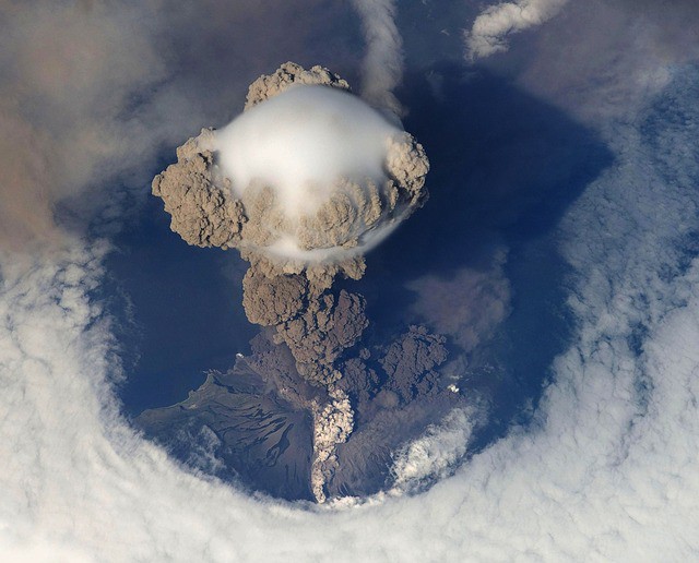
The Pacific plate hosts the Ring of Fire or Circum-Pacific Belt. It is a 25,000-mile string of volcanoes and seismically active sites that outline the Pacific Ocean.
2. North American Plate
With an area of 76 million square kilometers, the North American Plate is the world’s second-largest tectonic plate. The North American Plate started forming approximately 300 billion years ago when the planet was much warmer.
This plate not only contains the continent of North America but also part of the Atlantic Ocean. The continental crust encompasses Greenland, the northern Caribbean, and parts of Siberia, Iceland, and the Azores in Portugal. It also includes the northern island of Japan.
- The edges of the North American Plate exhibit all three types of tectonic boundaries:
- San Andreas Fault, a transform boundary between the Pacific Plate and the North American Plate
- Convergent boundary of the Pacific-North American plate near Alaska
a divergent boundary in the middle of the Atlantic Ocean, where the North American Plate borders the Eurasian Plate. This also created the Mid Atlantic Ridge, a chain of submarine ridges in the Atlantic.
The North American Plate is moving west southwest about 2.3 cm per year. This may seem like slow motion but over geologic time scales, these movements can create remarkable geological sub-provinces.
3. Eurasian Plate
Eurasian Plate, the third-largest tectonic plate spans all of Asia and Europe. The European countries situated on the plate includes England, Germany, Norway, Sweden, Finland, Austria, Poland, and Ukraine. Central Asian countries like Kazakhstan, Uzbekistan, Turkmenistan, and Mongolia are also part of Eurasian Plate.
Sandwiched between North American and African Plate on the north and west sides, it covers a total of 67.8 million square kilometers area. On the Southern side, it has the Arabian, Indian and Sunda plates as the neighbors and along the eastern side, the Philippine Sea plate is being subducted.
The Eurasian Plate hosts a plethora of volcanoes, triple junctions, seismically active faults, flood island basalts, and accretionary wedges. Its southern and eastern boundaries are the most tectonically active.
The most prominent geological formation associated with the Eurasian Plate is the uplifting of the Himalayas. The Himalayan mountain range is the result of the collision between the Indian Plate and Eurasian Plate which began approximately 50 million years ago.
On average, the Eurasian Plate is moving away from the North American Plate at a rate of 3cm per year.
4. African Plate
With an estimated area of 61.3 million square kilometers, the African Plate is the fourth largest plate tectonic boundary in the world. It includes not only the whole African continent but also large amounts of the Atlantic and Indian Oceans.
Africa was once the center of Pangaea, the massive supercontinent that existed about 300 million years ago. Since then South Africa, India, and Antarctica have split away from Africa. As a result, the African plate has three mid-ocean ridges (divergent boundaries) along the eastern, southern, and most of the western sides.
At these boundaries, the continent shifts away, and hot magma from the volcanoes seeps up, creating new seafloor. On the northern side is the convergent boundary where the African plate is subducting below the Eurasian plate.
The African plate seems to be splitting apart faster than what Geologists have imagined. The East African Rift (EAR) aka Afro-Arabian Rift Valley, is the end-result of diverging motion between Eastern and Western Africa. The tear, which continues to grow is making the scientific community debate whether African is in fact made of two tectonic plates, or if the continent is splitting in two.
A recent paper published to Nature Communications showed that large portions of the African Plate have disappeared over the past 200 million years.
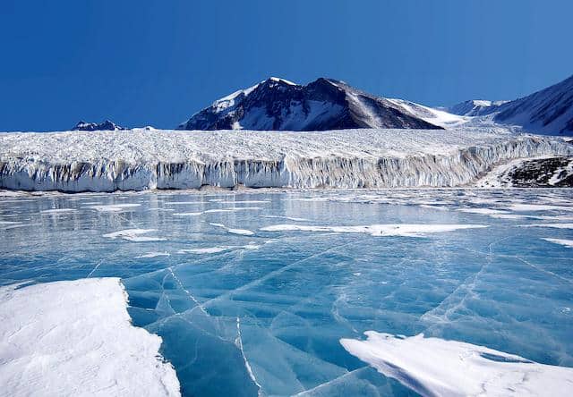
5. Antarctic Plate
Besides being the fifth-largest plate on earth, Antarctic Plate is also the world’s southernmost plate. Stretching roughly around 60.9 million square kilometers, it encompasses the continent of Antarctica and further stretches outward under the surrounding oceans.
Antarctica was once part of Gondwanaland, the southern half of the Pangaean supercontinent. Gradually, Antarctica split away from the other continents and moved southwards and reached its current location about 30-60 million years ago.
The Antarctic Plate borders the African Plate, the South American Plate, the Nazca Plate, the Indo-Australian Plate, and the Scotia Plate. By bordering the Pacific Plate, it also creates the Pacific-Antarctic Bridge.
Tectonically, the Antarctic Plate can be separated into two distinct components: the West Antarctic, comprised of numerous partially-submerged microplates, and the large craton of the East Antarctic, which is divided by the West Antarctic Rift System.
It is estimated that the plate moves at a snail’s pace towards the Atlantic Ocean – just 1cm per year.
6. Indo-Australian Plate
At about 58.9 million square kilometers, it is the second smallest tectonic plate on Earth. It was formed out of a merger of the Indian Plate and Australian Plate about 40-43 million years ago. Indo-Australian Plate stretches from the continent of Australia to the Indian subcontinent. It also includes some parts of Antarctica in the south, the Indonesian Islands and New Guinea in the north, New Zealand in the east.
Indo-Australian Plate is currently moving to the north-east at about 5-7 cm a year. One of the forces that drive the movement is the subduction along its northern sides as the plate is subducted along the Pacific Ring of Fire. However, the upper mantle of the plate is moving at a slower rate – about 2-3 cm a year.
7. South American Plate
South American plate, the smallest among the tectonic plate covers 43 million square kilometers. It is one of the tectonic plates Pangea broke apart to about 200 million years ago. It encompasses a continental portion (South America) and an oceanic portion (South Atlantic).
The plate is bounded by African plate in the east, Nazca plate in the west, Antarctic plate and Scotia plate in the south, and Caribbean plate and North American plate in the north.
South American plate and Nazca Plate share the longest convergent boundary, forming Andes Mountains which extends over 7000km. Active volcanoes and tectonic activity are more in convergence boundaries; Andes Mountain range has 200+ active volcanoes due to the convergence between Nazca plate and South American plate.
References:
https://www.science.gov/topicpages/p/pacific+plate+boundary
https://pubs.usgs.gov/publications/text/himalaya.html
https://pdfs.semanticscholar.org/1a85/01d772e7291596fdce0ed827192477399462.pdf